Surveying Department
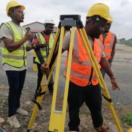
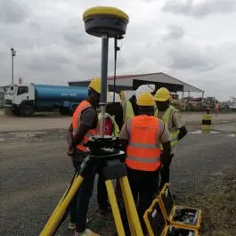
Our Survey Department provides complete equipment and service solutions for field survey professionals and engineers. From boundary surveys to construction layout, we deliver tools that ensure accurate measurements and data integrity.

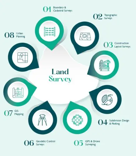
Survey Services Supported
Survey Services Supported:
- Boundary & Cadastral Surveys
- Topographic Surveys
- Subdivision Planning
- Geodetic Control & Construction Layout
- GPS & Drone Surveying
- Urban Planning & GIS Mapping
- BIM and Structural Monitoring.
Products Offered
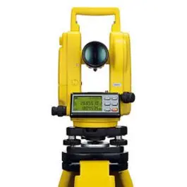
- Total Stations – Robotic and manual systems for high-precision angle and distance measurements.
- Levels (Auto & Digital) – For elevation and grading tasks in construction.
- Locators – For underground utility detection.
- Survey Field Software – For data collection, real-time analysis, and integration with CAD/GIS.
- Survey Accessories – Prism sets, tripods, bipods, tribrachs, measuring tapes, and more.
Additional Services
- Equipment Setup
- Onsite Demonstrations
- Integration Support
- Survey Training Modules

To install this Web App in your iPhone/iPad press
![]() and then Add to Home Screen.
and then Add to Home Screen.
