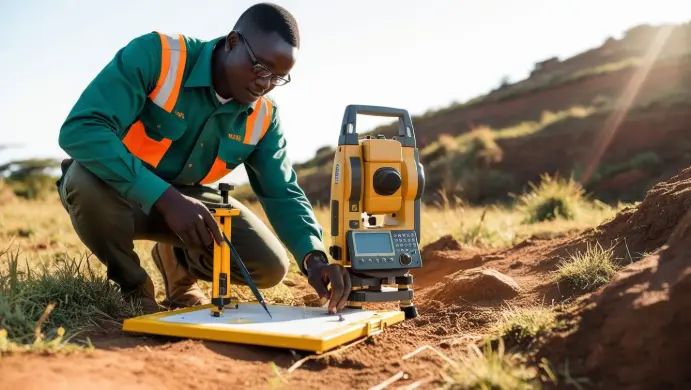

Our Surveying Services
- Boundary & Cadastral Surveys – Accurate land ownership mapping for legal and development purposes.
- Topographic Surveys – Detailed terrain analysis for engineering and construction planning.
- Construction Layout Surveys – Precise measurements for foundation and structural alignment.
- Land Subdivision & Platting – Systematic division of land for development projects.
- GPS & Drone Surveying – High-tech solutions for aerial mapping and geospatial accuracy.
- Building Information Modeling (BIM) – Digital representation of physical infrastructure for streamlined management.
- Structural Monitoring, Dam, and Bridge Surveys – Ensuring stability and safety in major infrastructure projects.

Our Key services
- Structural Monitoring – Tracking movement and stability of buildings, bridges, and dams to detect deformations and prevent failures.
- Utility Survey – Locating underground utilities such as pipelines, cables, and drainage systems to avoid disruptions during construction.
- Bridge Survey – Assessing the condition, alignment, and load-bearing capacity of bridges for maintenance and safety compliance.

Our services
- Calibration Services – Accurate calibration for total stations, GNSS, lasers, lab balances, pH meters, ovens, thermometers, and other instruments.
- Repairs – Expert diagnostics and repairs for faulty or damaged equipment, restoring functionality efficiently.
- Preventive Maintenance – Routine servicing to optimize equipment performance and minimize malfunctions.
- Equipment Sales & Consultation – Assistance in selecting the right tools tailored to your needs.
- Training Programs – Practical training on proper equipment operation to ensure precision and reduce errors.

To install this Web App in your iPhone/iPad press
![]() and then Add to Home Screen.
and then Add to Home Screen.
